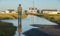
Projects to protect and rebuild Louisiana’s coast would be accelerated under a draft update to the state’s coastal master plan. But, for the first time, the plan concedes that no amount of land-building will save portions of the coast from subsidence and sea-level rise.
Based on new data, the 2017 update forecasts that the state will lose between 1,207 and 4,123 sq miles of land in the next 50 years. Previous plans had forecast no net land loss under some scenarios.
“The landscape has certainly changed,” said Bren Haase, who leads the Coastal Protection and Restoration Authority’s (CPRA) coastal master-plan planning team.
The new models and scenarios add urgency to the state’s $50-billion plan to restore and stabilize the coast. The plan recommends 120 projects to build or maintain land, including $19 billion for structural risk projects. Another $18 billion will be dedicated to marsh rebuilding and diversion projects.
The updated plan accelerates some projects based on the BP settlement for the 2010 Gulf of Mexico Deepwater Horizon oil spill. CPRA estimates that, including the settlement, oil-and-gas revenue and other funding, it will have about $10.7 billion available during the plan’s first 15 years.
Projects that have been accelerated or added include $1 billion in levee improvements for Ameila Island, an $8-billion Morganza-to-Gulf levee, and $2.4-billion for Lake Pontchartrain floodgates and a U-shaped levee to protect areas around New Orleans.
Arcadis and CB&I helped to develop the plan update, which still must be vetted by the public and approved by the state Legislature. About 20 Arcadis staffers worked with CPRA on project definition, cost estimation and modeling. Brett McMann, an Arcadis resiliency engineer working with CPRA, said, “Arcadis draws on its Dutch heritage in supporting CPRA on flood-risk reduction and ecosystem restoration planning, engineering and design.”


Post a comment to this article
Report Abusive Comment