Eleven coastal communities on Maine's Casco Bay are joining to use nature-based infrastructure to mitigate coastal flooding caused by the climate crisis.
A $250,000 grant from the National Fish and Wildlife Foundation and $250,000 in matching funds from the Gulf of Maine Research Institute, as well as and other grants and non-cash contributions, will support the two-year project that “aims to engage people whose livelihoods are affected by coastal flooding and help … plan for nature-based solutions to flooding,” said the Greater Portland Council of Governments, a regional planning non-profit, on Nov. 19.
The team expects to begin work in March, says Sara Mills-Knapp, council sustainability program manager, who is leading the regional initiative.
“The project will engage other organizations, including Casco Bay Estuary Partnership, Friends of Casco Bay, all of the land trusts and other conservation organizations working in the region … in addition to the municipalities,” she says. The projects will build on existing work, including state-level projects with sea level rise projections and data from the Maine Geologic Survey.
Earlier this month, the town of Brunswick became the latest to commit to joining the effort to prepare for environmental, social, and economic impacts of flooding.
In addition to Brunswick, municipalities involved in the project include Freeport, Falmouth, Cumberland, Yarmouth, Cape Elizabeth, Scarborough, Portland, South Portland, Chebeague Island and Long Island. The Casco Bay watershed comprises almost 1,000 square miles of land and hosts 20% of the state’s population.
“Now is the time to start planning for the solutions that will ensure our coast can be economically, environmentally, and socially resilient to current and future impacts,” Mills-Knapp, says. “We know that nature-based solutions to flooding are essential to protecting habitats and communities… in this important long-term planning effort.”
Early-stage work will require a significant amount of GIS mapping software, Mills-Knapp says. When discussing resilience at a regional scale, it is helpful to view in map format the types of infrastructure that may be at risk and what type of communities may be more vulnerable, she says. “That’s only possible when you have a broad view of the region.”
The team will provide climate projections using climate change modeling scenarios for flooding with projections for 2030 and 2050, Mills-Knapp says. “We’re really excited to have the Gulf of Maine Research Institute.” where a new sea level rise post-doctorate fellow is starting work, she says. The team will also help municipalities identify critical infrastructure, such as hospitals in flood-prone areas.
Before projects begin, the Portland-based council will conduct a baseline risk assessment, says Gayle Bowness, the institute's municipal climate action program manager. “You need to make informed decisions before investing in resilience projects.”
A large part of the federal grant will focus on nature based solutions, which “harness the power of nature to act as an effective defense system against flooding,” the council said.
Projects could include salt marsh and dune restoration, green infrastructure to reduce stormwater runoff, landscaping parks to mitigate flooding and runoff and other nature-based solutions. These solutions can be more sustainable and less expensive than hard infrastructure, Bowness says. “Instead of building a seawall, can we start rehabilitating a shoreline … to shore up some of the erosion … and … bring back some of the natural sediment,” she says.
Bowness adds that projects include a wide variety of stakeholders, including landscape architects and engineers. “They need to be … at the table when the conversation is around solutions and when we start addressing vulnerabilities, because we don't have a menu of solutions from which we can pick and choose,” she says.
The council plans to build its programs modeled after a similar program the Southern Maine Planning and Development Commission has been conducting, it said.
One of the greatest challenges for early-stage work is securing its workforce. “In every sector there’s been a huge turnover these past couple years … with many openings in planning positions in some of our municipalities,” Mills-Knapp says. While funding is available, the team must be sure it has its people and additional capacity, if necessary, she adds.
The Fish and Wildlife Service and the National Oceanic and Atmospheric Administration announced on Nov. 18 that the council was a grant recipient of the 2021 National Coastal Resilience Fund, which will invest $39.5 million in 49 projects to bolster natural infrastructure to protect coastal communities.
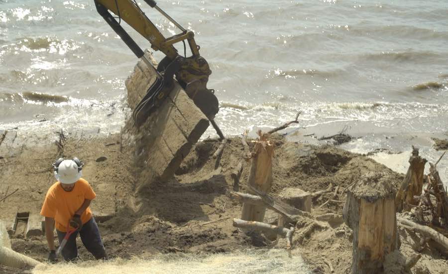
Last year in Brunswick and Yarmouth, two demonstration living shoreline projects took place along eroding shorelines that are part of a larger NOAA funded project involving all five New England states.
The goal of the Maine projects is to test small, low-cost living shoreline methods that could be transferable to other parts of Maine for eroding shoreline and coastal bluffs, says Peter Slovinsky, a marine geologist at Maine Geological Survey in Augusta.
“Maine has really high tides … and in winter it’s challenged by two-foot racks of ice,” he says. The team will monitor projects for five years to better understand how living shorelines perform in Maine and New England, he says.
.


Post a comment to this article
Report Abusive Comment