Updated 9/13/18 5:47 p.m.
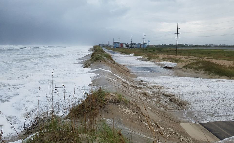
Hurricane Florence’s effects on coastal North Carolina increased markedly through Sept. 13, with severe overwash conditions forcing the state Dept. of Transportation to close State Route 12 on Hatteras Island.
Closer to Wrightsville Beach, N.C., where the storm is expected to make landfall Friday morning, officials of New Hanover County were preparing for a storm surge of nine to 10 feet on the barrier islands, as well as estuarine and inland riverine areas. Sustained winds are expected to accelerate to hurricane force speed by 9:00 p.m. on Sept. 13.
The erratic nature of Florence’s direction, speed and intensity has made it difficult to predict potential impacts on North and South Carolina’s coastal areas.
Andy Coburn, associate director of Western Carolina University’s program for study of developed shorelines, says the erratic nature of Florence’s direction, speed and intensity has made it difficult to predict potential impacts on North and South Carolina’s coastal areas. With rainfall projections of 30 inches or more, however, Coburn expects “widespread, and potentially devastating, coastal flooding that is very likely to exceed what eastern N.C. experienced during Hurricane Floyd in 1999.”
Coburn notes that although Florence’s downgrade to a Category 2 hurricane might lower storm surge levels, those reductions probably will be mitigated if the storm stalls offshore for an extended period, as some forecast models have indicated.
Should that happen, direct impacts to development might be lessened, while direct impacts to beaches, dunes and shorelines would increase.
“In other words, fewer buildings are likely to be outright destroyed, but more buildings will suffer damage as a result of foundation and roof failures,” Coburn says.
Other environmental impacts could arise from damaged sewer systems and exposed septic tanks, a common occurrence during storms along the state’s Outer Banks. “There’s also the possibility of a new inlet or two being created,” Coburn adds.
Meanwhile, state and local officials in South Carolina are bracing for an expected two-day rain that could dump 7 inches or more in midland and upstate areas, as well as higher levels closer to the coast.
Hydraulic models developed by the state’s Dept. of Natural Resources over the past four years are being used to identify and prioritize high-risk flooding areas, particularly the Pee Dee and Catawba River basins, both of which also drain several North Carolina waterways.
In the state capital of Columbia, hydraulic models and revised operational practices are helping the city’s water utility optimize flows through its primary drinking water supply source, the Columbia Canal.
The 2015 deluge of a 1,000-year storm opened a 60-ft wide breach in that canal, disrupting service to nearly 190,000 customers. Although the canal breach has yet to undergo permanent repairs, estimated to cost $169 million, Columbia’s water manager, Clint Shealy, told reporters on Sept. 12 that construction resources and materials have been positioned to respond immediately should another breach occur.


Post a comment to this article
Report Abusive Comment