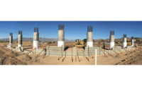
Work continues briskly for a late-December 2019 opening of the $1.66-billion Loop 202 South Mountain Freeway in Phoenix, the largest highway construction project and highway public-private-partnership in Arizona history.
The 22-mile roadway includes the state’s first half diverging diamond interchanges and one of the state’s first highway double roundabouts. Additionally, the roadway spans the Salt River by using twin 2,600-ft-long bridges that incorporate the state’s first use of Utah bulb tee concrete girders. The history-making build also required extensive utility work as well as close coordination with neighbors, including the Gila River Indian Community.
Connecting the east and west valleys through southwest Phoenix, the design-build project includes four segments from Interstate 10 and the existing Loop 202 San Tan Freeway interchange in the southeast of the Phoenix metro area to I-10 in the northwest, where five and a half miles of system interchange and widening are also being completed.
The Arizona Dept. of Transportation awarded the P3 to an integrated joint venture of three general highway contractors: Fluor Enterprises Inc., Ames Construction Inc. and Granite Construction Co. The three firms are working together as Connect 202 Partners LLC, or C202P, managed by Fluor.
A 30-year, $191-million contract for routine and long-term capital maintenance with a separate, but affiliated P3 company, 202 Maintenance Services LLC, is also included; this will be completed almost entirely by Fluor. No early completion incentive is included, although late completion penalties apply.
The South Mountain Freeway has three general-purpose lanes and HOV lanes in both directions on a rolling profile of at-grade, partially depressed and above-grade roadway. The HOV lanes seamlessly connect with those on I-10.
Four various-length segments are all nearing completion: Pecos, 9.4 miles; Center, 3.2 miles; Salt River, 5.8 miles; and I-10 Papago, 2.7 miles for the South Mountain Freeway and 5.5 miles for the I-10 connection and widening. Each of these segments incorporates aesthetic elements consistent with their topography, such as a leaf portal design for farm areas.
By completing the Loop 202 and Loop 101 freeways, the roadway will provide drivers an alternative to the I-10 path through downtown Phoenix, allowing them to circumnavigate the high-traffic areas. In addition, the highway is expected to reduce stress on arterial streets in the West Valley, a thriving residential and business gateway, and spur development of greenfield areas opened by the highway.
Much of the alignment lies amid farmland and the environmentally sensitive western end of the South Mountains, site of the country’s largest municipal park; this is adjacent to the Gila River Indian Community, which considers the mountains sacred. Tribal land is south and west of part of the new roadway and one community casino, Vee Quiva, is adjacent to the Center segment.
The new freeway is planned to meet today’s needs and expected area growth for the next 15 years. “We anticipate that the South Mountain Freeway will be used by about 117,000 vehicles per day in 2020,” says Robert Samour, senior deputy state engineer ADOT, and project director for the freeway, “and we expect that to grow to about 190,000 vehicles per day by 2035.”
Three Crews, One P3
First proposed in 1983 as the Southwest Loop and approved by voters two years later with Proposition 300, the South Mountain Freeway is 60% funded from fuel taxes authorized in 2004 through Proposition 400, which outlined a multimodal transportation system by the regional planner, the Maricopa Association of Governments. The remainder of the new highway is 40% funded by the Federal Highway Administration.
Since July 13, 2009, when then Gov. Jan Brewer signed HB 2396, ADOT has been empowered to use P3s for transportation projects, in part for the economies of scale and to encourage roadway innovation, Samour says.
To ensure teamwork, workers from the three contractors were fully integrated, led by segment managers from the companies. Travis Legare, for example, is an Ames employee managing the Salt River and Center segments; Bob Leerkes, Granite, is the I-10 Papago segment manager; and Mark Fisher, from Fluor, oversees the Pecos segment.
“From the start, we promoted ‘Leave your logo at the door.’ In team meetings, we stressed buy-in, that here we are all Connect 202.”
– Walter Lewis, C202P Project Director
Company cultures were immediately unified. Allegiances were directed toward one group, the P3, and the one goal of project success.
“From the start, we promoted ‘Leave your logo at the door,’” says Walter Lewis, C202P project director and a Fluor employee. “In team meetings, we stressed buy-in, that here we are all Connect 202. Without that, you build up silos.” On site, for example, the contractors use white pickups and wear protective equipment with the C202P logo.
Maintaining a unified safety culture has been a focus of weekly team meetings and new-worker orientations, he adds, noting that the C202P team marked its five-millionth hour with no lost time on Aug. 7.
United by this team spirit, each company has brought different expertise to the jobsite, Legare says. Ames, for example, is experienced in bridge-building, blasting and earthmoving and transported its crusher to the site to process blast debris from the mountainside cuts in the Center segment. Granite has established a reputation for asphalt paving and flatwork. And Fluor added Texas crews skilled with concrete structures and pavement.
A total of 269 subcontractors have worked on the project; these companies in turn hired subcontractors. At peak, the project employed more than 1,000 people, including 550 craftworkers, 230 designers, quality-inspection personnel, 400 subcontractor employees and other C202P staff.
Personnel shortages required C202P to bring in workers from Texas, Colorado and Nevada. Because of the robust Arizona economy, many workers are choosing to pursue more lucrative employment in the housing market; this has also challenged some suppliers. Still, everyone has melded. “The mentality has been as long as we have the right people, we are all part of the team,” Legare says.
In the last year, the project also instituted a 5% retention bonus to incentivize workers to stay through completion, Lewis says.
Crews are working 40 to 70 hours per week, including weekends when needed. “We monitor the hours based on temperatures and the heat index,” says Walter Fedrowitz, C202P deputy project director, alluding to desert summer temperatures that normally exceed 100 degrees.
Massive Numbers
For rights-of-way, ADOT purchased 219 parcels, mostly single-family and manufactured homes, while C202P handled 128 commercial/industrial properties, closely working with the owners to determine if partial or complete acquisitions were appropriate.
Altogether, 41 bridges and 15 interchanges have been built as well as the I-10 system interchange. A 414-linear-ft steel truss pedestrian bridge should open in the first quarter of 2020 in the Salt River segment, connecting the Rio del Rey community, which was bifurcated by the highway. A 200-ft ramp is on the east side, a 300-ft ramp on the west. Artwork by New York City’s Jody Pinto will be placed next year on stainless steel panels, as coordinated by the city of Phoenix Office of Arts and Culture.
Along the 22 miles of freeway, 12 miles of mechanically stabilized earth and sound walls are being constructed, totaling about 2 million sq ft. Approximately 360,000 cu yd of concrete has been poured, about half of this for the Salt River bridges just north of Southern Avenue.
In the Center segment, 2 million cu yd of rock was removed following blasting of two main South Mountain ridges. In the Salt River segment, 5 million cu yd of dirt and rock were removed and repurposed.
The roadway has 8 in. of asphalt, about a million tons; the top ½ in. is rubberized asphalt for sound-amelioration and ride softening. Finally, crews placed 187,000 ft of drainage pipe, drilled 33,000 ft of shafts and tied 36 million lb of rebar, some of which was recycled locally from project demolitions.
One Highway, Four Unique Segments
Each of the four highway segments has challenged the P3 differently.
In the Pecos segment there are established neighborhoods, requiring sound walls along the north side. The interchanges at Desert Foothills Parkway and 17th Avenue are the state’s first half diverging diamond interchanges — designed to increase efficiency and safety as well as reduce right-of-way requirements, Fedrowitz says.
As a result of ADOT-coordinated community outreach meetings, six miles of shared-use pathway between 17th Avenue and 40th Street will also be constructed in 2020 by C202P after the highway opens. This will replace the original Pecos Road on the south side of the highway, providing recreational opportunities for bike-riders and hikers.
“Our goal was to keep the blast more confined, with a lot less material per blast.”
– Walter Fedrowitz, C202P Deputy Project Director
In the connecting Center segment, with approval by the Army Corps of Engineers and the neighboring Gila River Indian Community, five multi-use crossings will serve as non-vehicular passthroughs for people and such animals as deer, javelina, desert tortoises and chuckwallas. There are also drainage culverts for runoff from the adjacent mountains. Approximately 39 washes in this area are protected as waterways of the U.S.; they must be returned to pristine condition after construction.
Extensive blasting was needed in this segment, requiring community outreach. Because the land is sacred to the Native American community, all rock in this segment had to remain in the area in some form. In fact, before blasting occurred, the mountains were blessed by a community representative. The rock was repurposed as embankment and subgrade for the roadway, Fedrowitz says. Because of the noise and possible structural impacts from blasting, subcontractor Aimone-Martin took surveys and images of the properties where homeowners were concerned.
To reduce these impacts, the blast areas were tightened, using 6-ft spacing between holes instead of 10 ft. “Our goal was to keep the blast more confined, with a lot less material per blast. You still get through the rock while reducing the impact,” Fedrowitz explains.
Phasing was required so that one side could be cut, excavated and cleared for equipment and crew, then the other side was completed, Legare says. To control dust and provide water for other project needs, approximately 15 temporary construction ponds were created there and in other segments, totaling about 1.1 million gallons, Fedrowitz says.
Roundabouts and Bulb Tees
In the Salt River segment at Estrella Parkway is one of the state’s first highway double roundabouts, built for efficient traffic flow and safety.
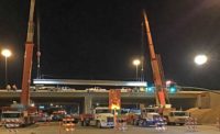
Between Broadway Road and Southern Avenue, the twin Salt River bridges include some of the largest precast concrete girders ever used in Arizona; more than 170 ft in length, the 169,000-lb girders are as long as a 17-story building is tall. All 1,004 were manufactured in Phoenix by Tpac and transported and placed during overnight hours. The largest, at 177 ft and 1 ½ in., is on the north span of the I-10 westbound connecting ramp and is considered the longest concrete girder ever installed in Arizona by ADOT.
“We worked heavily with C202P to run evaluations on different types of girders to find the most economical shape for the span configurations required for this project,” says Angela Galietti, lead bridge engineer for WSP USA, formerly Parsons Brinckerhoff, lead designers/engineers for C202P. “We were able to get longer spans with less concrete and fewer prestressing strands compared to other shapes with similar depths.”
Also in the Salt River segment, drainage channels with storage basins were built on the east side to retain large volumes and direct these to the Salt River. Multiple culverts were required under city arterials and other locations to provide a crossing for power and irrigation utilities, Legare says.
The construction in the I-10 Papago segment challenged the team with traffic and utilities coordination, particularly at the 59th-Avenue/Union Pacific Railroad overpass. The crew worked with the city of Phoenix and SRP transmission, distribution and irrigation groups and completed six jack and bore installations of various pipe sizes under the railroad.
In addition to the stringent requirements of working within the railroad right-of-way, protection and monitoring of existing utilities were required for fiber-optic lines and a Kinder Morgan fuel line servicing Luke Air Force Base, segment manager Leerkes explains.
The developed area combines homes and businesses requiring uninterrupted access to local roads and I-10. “We had to maintain typical through-traffic volumes along with local business access through intense phasing, restrictions and closures,” he says.
The I-10 section required continuous closures throughout 2018 and 2019. “We provided an incredible volume of community outreach,” says Crystal Rubin, the public involvement manager for the project. “We coordinated with ADOT, the city of Phoenix, Maricopa County, first responders, school districts and major entertainment venues.
Utility Challenges
Moving and reconnecting water, sewer, electrical and fuel lines have been a major focus. These include 218 relocations, the majority with Salt River Project, the Phoenix area’s largest supplier of electricity and water.
At the Broadway Road overpass in the Salt River segment, C202P and SRP met the utility company’s “most significant design and construction challenge on the South Mountain Freeway,” says Curtis Chaney, an assistant project manager in SRP’s transmission line design group.
“We anticipate that the South Mountain Freeway will be used by about 117,000 vehicles per day in 2020.”
– Robert Samour, Senior Deputy State Engineer, ADOT, and Project Director for the South Mountain Freeway
A 69-kV system is on the south side of Broadway Road and a 230-kV system on the north; because of the proposed overpass at this location, both had to be vertically adjusted. This required temporarily moving them, adding shoo flies as the overpass was built and placing taller poles meeting National Electrical Safety Code clearances after construction was completed, he says.
And, in the I-10 Papago segment, SRP designed and installed eight concrete irrigation siphons under I-10 between 43rd and 75th avenues, requiring significant coordination with C202P to locate the new siphon manholes/vaults in order to avoid conflicts with the freeway widening, sound walls and frontage roads, explains Kyle Tilghman, the utility company’s director of water engineering and transmission.
The freeway also necessitated 53 water line and sewer relocations with the city of Phoenix. One, on Liberty Lane, a collector street just north of the freeway in the Pecos segment, was “the most challenging part of the project,” says C202P’s Lewis. This involved relocating approximately 7,500 linear ft of 48-in.-wide transmission main at a depth of 20 ft. The pipe was hose fed with oxygen for the benefit of the welders inside.
Sacred Land
The P3 has had to adjust to unique scheduling, allowing it to start on three of the four segments, and a year and a half later, to begin the particularly challenging Center segment.
In May and June 2015, following FHWA approval of the highway, the Gila River Indian Community and the community group Protecting Arizona’s Resources and Children (PARC) jointly filed lawsuits against the FHWA and ADOT to prevent construction.
The Native American tribe argued that the construction would destroy areas of South Mountain, which they call Muhadagi Doag, and destroy or alter sacred trails, shrines and archaeological sites. In turn, PARC was concerned about air quality, wildlife connectivity and waterways.
ADOT in part countered that, beginning in 2001, it had coordinated a 13-year environmental impact statement on the proposed highway, noting that only approximately 0.2% of the South Mountains would be altered by the alignment. An injunction was denied.
ADOT and C202P signed a contract on Feb. 26, 2016. On Aug. 19, 2016, the U.S. District Court ruled against the plaintiffs, and a notice to proceed was issued seven days later allowing C202P to start work on three segments: Pecos, Salt River and I-10 Papago, while barring any work on the Center segment. On Dec. 8, 2017, the U.S. Court of Appeals again sided with ADOT and the FHWA and an NTP for C202P to begin work on the Center segment followed on Feb. 7, 2018.
While C202P proceeded under these conditions, three change orders have intensified the challenge to complete the work on time. These include full interchanges at 32nd Street in the Pecos segment and Ivanhoe Road in the Center segment as well as the addition of a superbox underpass at West Ray Road and West Dusty Lane, also in the Center segment.
ADOT, MAG and the Gila River Indian Community agreed that a full interchange at Ivanhoe Road, now Vee Quiva Way on its side of the freeway, would alleviate traffic and benefit flow into and from the casino.
The team coordinated with the Native American community on other issues.
“Everyone working on the project had to first go through cultural sensitivity training with a representative of the community,” Fedrowitz explains. “So you learned to view the project through the eyes of the community as well as what to do and who to call if you find any artifacts during excavation.”


Post a comment to this article
Report Abusive Comment