When the North Cascades Highway opened in September 1972, it lasted just two months before snow closed the 37-mile stretch through Washington’s North Cascades mountain range. The two-month window was a fitting omen of what was to come for the roadway.
Ever since that first 1972 winter, Washington State Dept. of Transportation crews have arrived each spring to clear snow from the highway connecting the Skagit River Valley on the range's western side with the high desert of the Methow Valley on the east. This clearing process open's the state’s northernmost pass for roughly six months before snow shuts down the gates at mileposts 134 and 171. The only winter that hasn’t shut down the roadway was that of 1976-77.
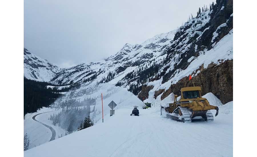
This May, crews again finished the seven-week clearing process, opening the roadway. Maintenance crews and avalanche technicians clear ditches of debris, repair and replace guardrails and pavement, and conduct controlled snow slides to clear chutes above the road. When snow starts filling up avalanche chutes again, safety becomes an issue and the gates close, usually around Thanksgiving.
Opening the roadway each summer allows for a new route to connect travelers while opening up more miles of US Bike Route 10 and access to additional hiking and camping options for outdoor enthusiasts.
The highway's route leaves the Skagit River Valley near Burlington, crossing the mountain range's jagged peaks past rock spires, hanging valleys, waterfalls, alpine glaciers and Ross Lake before hitting the high desert and Old West feel of Winthrop in the Methow Valley. Its history began in 1895 with the first state funding to explore a possible route through the range. State history shows that the route was used for years by Native American traders and then in the mid-1800s by settlers arriving in search of gold, fur and places to live.
The 1896, State Road Commission selected the Cascade Pass route along the Cascade River, roughing out a wagon trail to a cabin, shown as State Highway #1 on early maps. Just a year later, a flood took out the wagon route.
In the early 1900s, a pair of dams in the mountain range spurred the development of more roadway. By 1940, the concept of the Cascade Pass highway was dropped and all interested parties agreed that a route across Rainy and Washington passes was the most suitable option. As support for the road grew in the 1950s and 1960s, a rough pioneer road was completed in 1968, one month before President Lyndon B. Johnson signed the North Cascades National Park bill. On Sept. 2, 1972, the North Cascades Highway, now known as State Route 20 across Rainy and Washington passes, officially opened.
Follow Tim Newcomb on Twitter at @tdnewcomb.

Post a comment to this article
Report Abusive Comment