

By Kimberly Kilroy, PE, RRC, CDT and Peter Spanos, PE, CFM, LEED AP
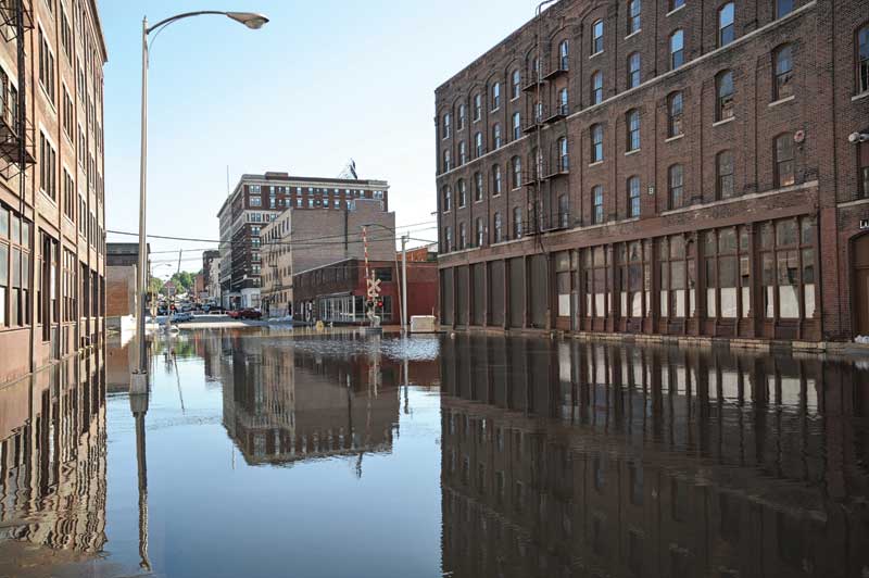
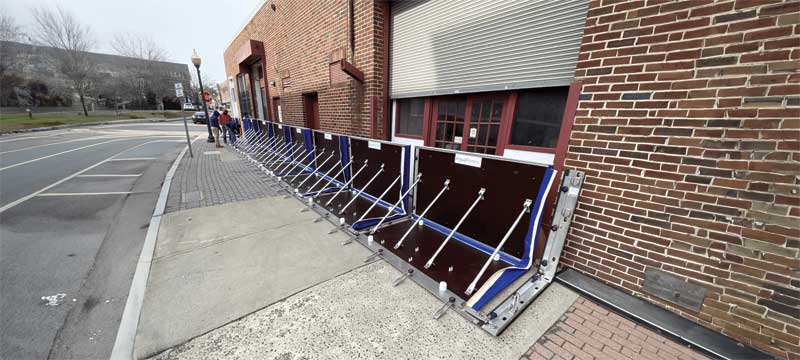
As sea level continues to rise and weather patterns become more severe and less predictable, flood mitigation is becoming a critical part of new construction design and existing building renovations and maintenance. Whether the motivation is building code compliance, building protection and performance, or insurance premium reductions, it is necessary for facility owners and managers to address flood risk and determine how to protect their facilities.
Sources of flooding
Typically, the first step in the flood mitigation process is assessing the flood risk for a given site. Sea level rise presents a potential source of flooding for coastal areas (i.e. coastal flood/storm surge). Flooding of streams and rivers presents a potential source of flooding for those in the vicinity of such waters (i.e. fluvial floods). However, even beyond these “obvious” areas of potential flooding, severe storm events catalyzed by climate change with increased rainfall rates and/or durations can increase the risk of flooding for many areas, even unexpected ones.
To assist in identifying areas susceptible to flooding, the Federal Emergency Management Agency (FEMA) developed flood maps in 1968 after Congress passed the National Flood Insurance Act. The maps delineate zones (listed below) to represent flood potential and identify areas susceptible to flooding in a 100-year storm (1 percent annual chance or higher) as “special hazard flood areas.”
- Zones B, C, and X are areas of low to moderate flood risk.
- Zone A has a high risk of flooding.
- Zone V has a high risk of flooding at a coastal area where storm waves present an additional hazard concern (i.e. velocity hazard/wave action).
- Zones A and V are supplemented with a secondary letter in some locations (where applicable) to provide more detailed information about the Zone.
○ Zone AE indicates a Base Flood Elevation has been assigned to the area.
○ Zone AH indicates flood depths of 0.3 to 0.9 m (1 to 3 ft) via sheet flow are anticipated.
○ Zone AR indicates an area previously identified as high flood risk, which has since been decertified as maps were revised.
○ Zone A99 indicates an area to be protected by a federal flood protection system that is in construction, such as a levee or a berm.
○ Zone VE indicates a base flood elevation has been established for this Zone V area.
○ Zone D identifies unstudied areas where flood hazards have not yet been identified.
These maps are publicly available and can be accessed virtually through an interactive tool on the FEMA website.1

