Geographic Information Systems and Building Information Modeling have developed side-by-side over a period of more than three decades, with civil engineers, architects and contractors using both types of data to better inform airport, transit, road and even general building projects.
Despite these parallels, the twain have never met over those years of development. GIS captures and creates opportunity for analysis of spatial and geographic information, while BIM, with its related parameters focused on a building’s tolerances and construction phasing, captures the interactions of a building and its infrastructure.
Autodesk and Esri—the company that invented Geomapping in the 1960s and has been the dominant player in GIS technology from its Redlands, Calif., campus—announced a new partnership in 2017 on workflows linking GIS and BIM. At its user conference in June this year, ESRI showed off a new product: ArcGIS GeoBIM. As the dominant GIS vendor, it’s a significant move for Esri to say it has built a web portal for connecting ArcGIS to Autodesk Construction Cloud.
Even though it’s just the beginning of the integration, such GIS-to-BIM workflows could eliminate the wholesale recreation of data from one system to the other that is currently required, a problem that has generated mountains of repetitive work for virtual design and construction departments over the years.
John Tocci, Jr., VDC manager at PCL Construction Services in Los Angeles, ran up against the quirky U.S. survey ft, a standard unit of measurement common among surveyors, when he was starting work on the Consolidated Rent-A-Car facility for Los Angeles International Airport’s Landside Access Modernization Program. All of the survey data on the airport’s land was listed in survey ft, a measurement first adopted by the U.S. in 1866, which specifies that one meter is equal to 39.37 in. and 1,200 m is equal to 3,937 ft. To convert survey ft to meters, Tocci and his team had to divide those two numbers.
“You come out with a decimal that has 10 places [.3048006096],” he says. “The U.S. survey foot is different from the decimal foot, because with the decimal foot, they just kind of truncated it to 0.3048.”
Tocci says that what ended up happening was, since the survey ft doesn’t match up with a decimal ft but isn’t really used outside of surveying, the Autodesk software they used couldn’t handle the conversion.
“You end up with a shared coordinate system that’s actually inaccurate when you’re round-tripping data, just assuming a foot of one sort is the same as a foot of another sort, when your shared coordinate system is based on your survey coordinates,” he says.
The only answer at the time was recreating all of those coordinates for the project in decimal ft.
The survey ft was finally added as a unit of measurement in Revit and Civil 3D last year. But ArcGIS GeoBIM goes beyond just resolving small issues like that, and is the result of years of work. Autodesk and Esri have worked on open APIs and better data sharing, but ArcGIS GeoBIM is the first product that engineers from both vendors worked on together, blending survey and design workflows.
The web-based service is still being tested ahead of its launch later this year, but ENR spoke with several engineers testing it who said its workflow, so far, is an important first step in bringing about a better GIS-to-BIM data experience.


HNTB’s 5D digital twin for Jamaica Station allows vertical and horizontal views, highlights staging areas and lets them be used as a spatial bookmark.
Screenshots courtesy of HNTB
“What we’re trying to create is a single source of truth access point for anyone on the team to see the latest design information, whether that’s coming from 2D civil [bird’s-eye view] as well as the 3D design aspects, which all need to be visualized in 3D vertically,” says Darin Welch, HNTB associate vice president and national geospatial and virtual engagement manager. “We need a way to see horizontal and vertical in a way that brings all of that information together in that single source of truth.”
Both horizontal and vertical views are needed for projects such as rail lines, train stations and airports since they show how a whole system interacts while also offering detail on individual components, such as stations and platforms. GIS and BIM data both have roles to play in this comprehensive view.
For the Long Island Rail Road’s Jamaica Station capacity improvements project, Welch and his team at HNTB put on their programmer hats and built a 5D digital twin that had design, schedule and cost estimates for the 10 main stages of the project and 29 sub-stages. The 5D model brought together data from 3ds Max, ArcGIS CityEngine, Microsoft Project, Microsoft Excel, Esri’s Javascript API and other sources. It was a lot of work, but the Jamaica Capacity Improvements Virtual Design and Construction Explorer has helped HNTB keep the project on schedule for completion later this year.
“We need to see horizontal and vertical in a way that brings all of that information together.”
Darin Welch, associate vice president and national geospatial and virtual engagement manager at HNTB
HNTB is the lead heavy civil engineer on part of the expansion of O’Hare International Airport in Chicago. The engineer is designing a central tunnel system for utilities, baggage and passengers. The total cost of the project is expected to be $1.4 billion. “The passenger tunnel is the one that we have been kind of slated to prototype our ArcGIS GeoBIM early adoption,” Welch says.
He says there is less dependency on 4D and 5D modeling on that project than on Jamaica Station, but more reliance on how HNTB pulls together source files from multiple consultants and contractors, along with the 3D BIM data. Airport officials have discussed bringing all project data into a single visualization product for coordination and clash detection. “This is a new underground tunnel,” Welch says. “It’s a pretty extensive underground utility at work at an airport.”
Welch explains that HNTB and the Chicago Department of Aviation have already determined the general tunnel location and are now refining functions and placements. “They have a Point A and Point B but we’re figuring out how it’s laid out in between and how we will allocate the spaces for cargo transfer versus passenger and intermix, all of that with minimal impact to things like utilities.”
After using ArcGIS GeoBIM, Welch sees it as a positive development for establishing a connection between GIS and BIM. “You are connecting directly to Autodesk Construction Cloud’s BIM 360 from ArcGIS Pro, or Autodesk Civil 3D is connecting directly to ArcGIS online or enterprise directly to those managed data services,” he says. “Where we aren’t quite [at] yet is being able to have that same true integration without translation [of the data]. That is not on the web yet. The promise, for us in ArcGIS GeoBIM is it’s the first really strong step toward true web integration.”
Another complex infrastructure project that required robust data from both GIS and BIM is HDR’s design of the $8.2-billion Ontario Line transit system in Toronto. As technical advisor, HDR was responsible for 10 miles of subway, 15 stations, 3D clash detection and project management, models to support 4D phasing, and comprehensive GIS portals that dynamically integrate 2D and 3D design data.


ArcGIS GeoBIM lets engineers and VDC managers simultaneously view a building model and its attached information alongside a GIS map with its assets and 3D data.
Screenshots courtesy of ESRI and HDR
HDR’s BIM 360 common data environment shows project progress on a weekly basis, including design progression that integrates a 2D design layout and 3D information to help designers and contractors better contextualize how information fits together. It is currently composed of more than 320 design models and is expected to contain more than 400 by the time of its completion in 2027.
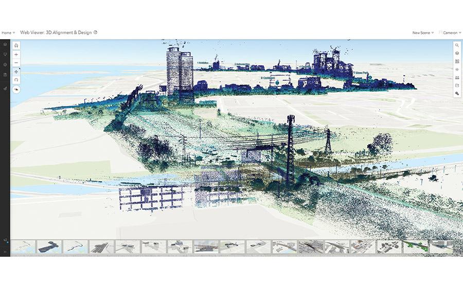
“I think we’re at just over four terabytes now of reality capture data specific to point clouds,” says Cameron Schaefer, transportation data acquisition and reality mesh director at HDR. “We’ve got underground stations, we’ve got above-ground stations, we’ve got all forms of LiDAR data whether it’s fixed wing, helicopter, mobile and terrestrial LiDAR.” HDR’s BIM 360 solution connects to a 3D GIS viewer of vertical and architectural models and integrates reality meshes and LiDAR sources that puts every part of the project into context.
"It’s one thing to bring the 3D models into a GIS environment where you’re looking at a generally flat at grade GIS Map, but you’re not getting the context and the accuracy of the buildings, grading or drainage in relation to real world elevations," Schaefer says. “With our reality capture data, we have assets like the streetlights and the guy wires. You’re seeing all of that collectively when you bring in the high resolution point cloud data.”
The BIM 360 cloud connection tool allows HDR to dynamically connect and pull data from GIS. Schaefer has also tested ArcGIS GeoBIM and thinks it opens up possibilities, too
Schaefer says this allows the user to see the data layers and levels of a 3D model.
“You’re really getting down into the metadata that is structured within Autodesk Civil 3d or Revit model, as it is intended within that native design platform versus the comparable tool within an Esri scene.”
Currently ArcGIS Pro offers “scenes,” a way of tilting up 2D maps and presenting some associated 3D model information. Schaefer calls it a “semi-helpful tool” that allows a user a limited way to view 3D models in ArcGIS Pro, but it doesn’t allow a user to dive into the data of a 3D parametric model.
For downstream users, GeoBIM gives them both environments, Schaefer said. It gives the simplified GIS version, and then for buildings, utility tunnels and other things that have BIM information in them, a user can open up the model, search property set names and be connected to what is available in BIM 360 in the same screen. It connects what is already available in BIM 360 and brings it up in the same screen.
“I could have a scene open on one screen and I could have BIM 360 open on another,” Schaefer says. “It would be very similar to the functionality that GeoBIM has. The difference is that I would have to search through a folder hierarchy on BIM 360 each time, rather than visually use navigation. I’d have to find a model. I’d have to hunt through folders to find that model.”
For Esri and Autodesk, this meant integration of more than than just data. The two vendors have been working together since 2016 on interoperability.
“[Without ArcGIS GeoBIM], I’d have to find a model. I’d have to hunt through folders to find that model.”
Cameron Schaefer, transportation data acquisition and reality mesh director, HDR
For Esri and Autodesk, this partnership means integration of more than just their data. The two vendors have been working together since 2016 on broader interoperability as well.
“We had divested from a product called Autodesk Utility Design in 2016,” says Theo Agelopoulos, senior director of architecture and engineering design strategy at Autodesk. “That that was kind of when we were beginning to focus more on what is our core business, which is really around designing, building.”
Chris Andrews is group product manager of geo-enabled systems and SmartCities/3D at Esri, but he previously worked in cloud services at Autodesk. In 2016 he and Agelopoulos got their respective CEOs (Carl Bass at Autodesk and Jack Dangermond at Esri) together and came up with a three-phase plan that began with the product integrations between ArcGIS Pro, Revit and Civil 3D. The next phase, Agelopoulos says, was around connecting the companies’ products not just into each other’s data, but also connecting them from a product-to-cloud or product-to-enterprise database perspective.
“An IFC model is a database with 700 tables all its own,” says Anthony Renteria, Esri’s product manager for ArcGIS GeoBIM. “And then a GIS can have hundreds of tables storing other types of information about assets. It’s more about using both to do something that simply wasn’t possible in any other way in the past.”

More than 300 models and several different types of LiDAR scanes were integrated into HDR’s BIM 360 visual representation of the Ontario Line project in Toronto.
BIM Integrated Project Map courtesy of HDR
Andrews says the first two years of the Autodesk-Esri partnership were really about both vendors proving they could do this, shifting product road maps so they could even begin to align. Connectors, points where data could be shared across databases and cloud infrastructure by both companies, were identified and work began on proper integration.
“Just bringing a layer into an application, that’s been possible since the connectors effort started,” Andrews says. Development hastened over the years to the point where ArcGIS GeoBIM was possible as an actual service, the third phase of the partnership.
“Seeing the project in context with adjacencies—whether it’s additional buildings or utility lines around the site—[and] being in coordination with those constantly allows you to visualize this information within a web browser,” Renteria says. “That was game changing. You’re not just using it internally for internal coordination purposes, but also opening that up to discussions with other teams as well.”


Post a comment to this article
Report Abusive Comment