In the latest consolidation move in the tightening construction software market, wetlands documentation app company Ecobot announced it has acquired software maker WetForm, one of its main competitors. The sale was a combination of stock and cash, and the valuation was not disclosed. Ecobot is a mobile app that automates much of the reporting paperwork required for wetlands documentation (ENR 4/20 p. 79). WetForm’s software offers similar capabilities.
While Ecobot plans to fold much of the functionality of WetForm’s software into its own app, the company plans to support WetForm and its customers for at least three years, says Lee Lance, co-founder of Ecobot. “If they are happy with the solution they have, we will continue to support them, but we want to give them a look at Ecobot as well,” he says.
Patrick Murphy, founder of WetForm and an environmental scientist, will join Ecobot as its senior wetlands scientist. “I want to hand the baton off, and I like the attitude so far of Ecobot. I like the fact they’ve incorporated things I wanted but knew I could never incorporate,” he says. “Ecobot does stuff WetForm will never touch like the GIS; being able to do the line work; pulling up soils maps.”
Wetlands documentation is an often tedious part of environmental reviews. The complexity of paperwork to submit to the U.S. Army Corps of Engineers as well as the highly variable documentation requirements in different states and regions can be an onerous task.
Bringing the dense knowledge of arcane wetlands documentation requirements from WetForm into Ecobot’s system was a key driver of the acquisition, says Lance. “It’s not about getting the code in their software, but the deep understanding of the processes involved in regulatory compliance.”
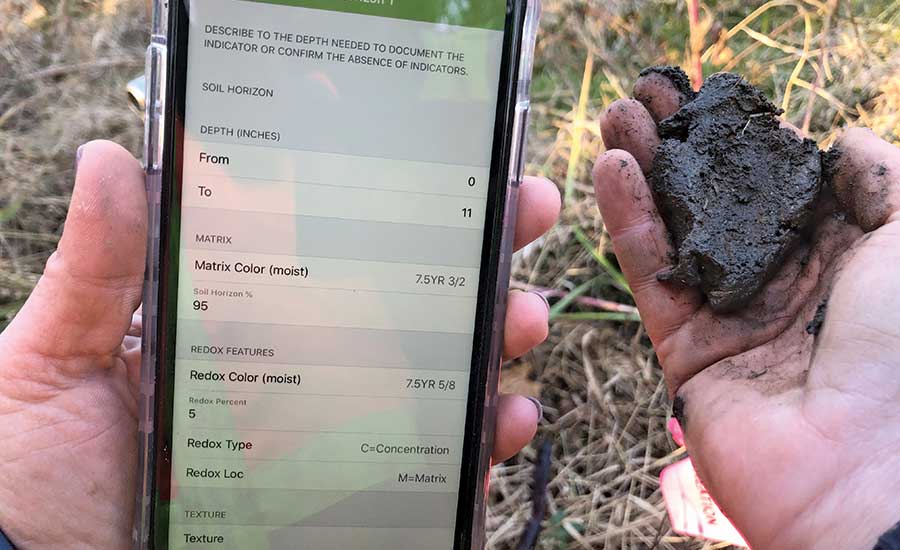
Ecobot can automatically populate data into required wetlands paperwork and can also copy relevant data over between related forms, saving time and avoiding duplication errors. This can save firms from legal headaches later, as some of these wetlands assessments may turn up in future litigation. The app can also be paired with a GNSS receiver for sub-meter-accurate location data.
Given the demands of doing this work in the field, any help is usually welcomed, explains Murphy. “[Wetlands scientists] don’t have a drone that can take a soil sample or evaluate flooding. It’s a complicated human brain thing,” he says. “You have to do it in the heat, the mosquitoes, the wind, the sun. The more it can be automated the better.”


-copy_ENRready.jpg?height=200&t=1660150075&width=200 "reality capture technology")
Post a comment to this article
Report Abusive Comment